|
NOTE: This article is about the Nogova terrain in ArmA: Cold War Assault. For the country of the same name, see Nogova. |
Nogova is a playable terrain in ArmA: Cold War Assault.
Overview
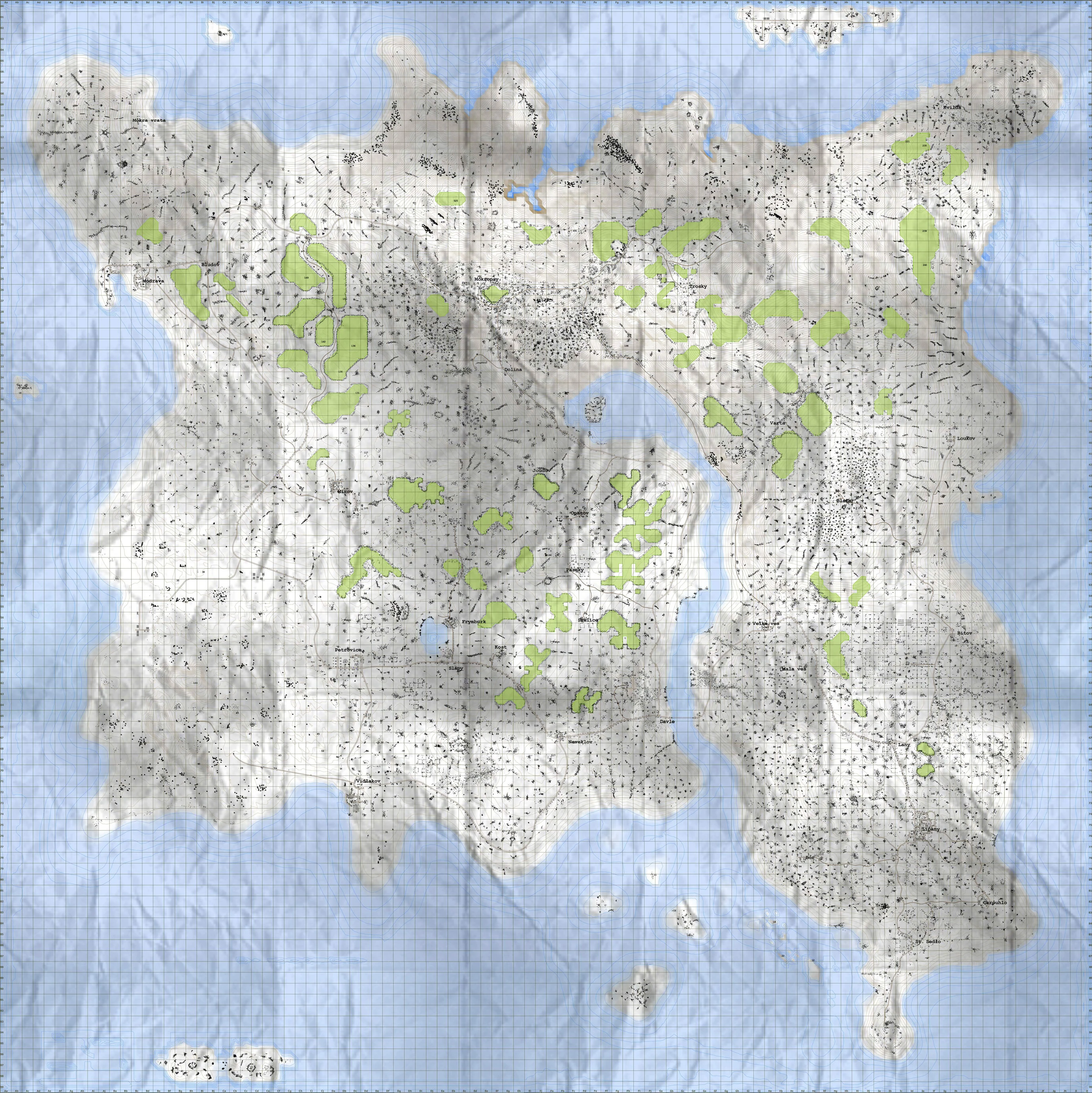
The largest of the three islands in the Malden islands chain, Nogova is home to thousands of fishermen, farmers and industrialists. From miniature deserts in the south-west to pine forests and steep mountain valleys in the central and northern highlands of the island, Nogova is undoubtedly one of the more diverse terrains in the region.
Geography


From snow-capped peaks in the north-east to a micro desert in the south-west, Nogova boasts a truly unique set of environs
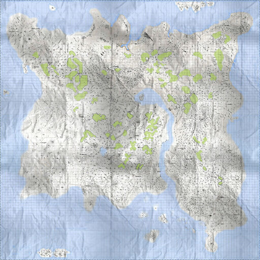
Excluding the surrounding waters, Nogova clocks in at a total size of approximately 100 square kilometres.
Nogova's terrain is heterogeneous but unlike Everon, the island's forested areas consist exclusively of pines littered with the occasional outcrop of rocky formations.
A narrow inlet (the River Vltavice) cuts directly through the centre of the island which almost divides the island in half. It can be crossed via the bridge in the south (at the town of Davle) or through the road in the north (between the towns of Mokropsy and Trosky).
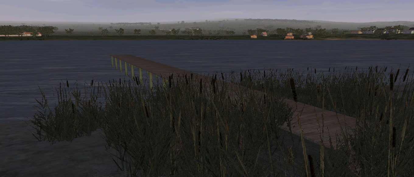
Frymburk lake
Only one inland body of water exists and remains fully isolated from the sea. Located west of Frymburk, this lake dries up during the summer seasons and only becomes flooded during periods of heavy rains. No aquatic life exists in the lake, though water reeds thrive near the edges of the lake whenever it is inundated.
The tallest point on the island is the snow-capped peak east of the village Trosky. It reaches an altitude of 744 metres above sea level.
Settlements
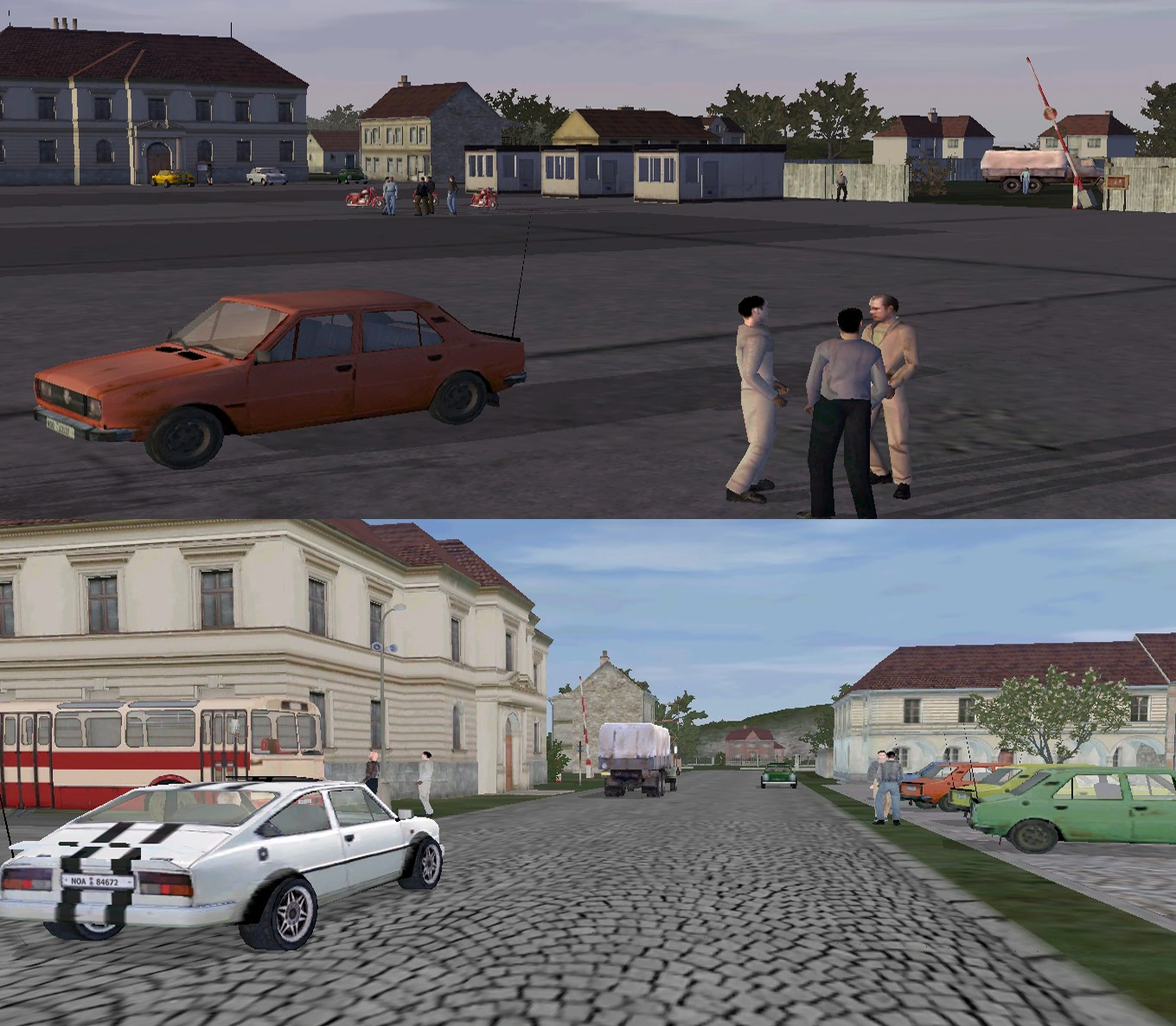
Daily life in Petrovice (top) and Lipany (bottom), the two largest settlements on Nogova
Nogova has almost a total of thirty cities, towns and villages scattered throughout the entire island. The city of Lipany serves as the nation's defined capital.
Similar to both Everon and Malden, Nogova's scattered villages mainly consist of clumped-up dwellings intertwined with farms along with churches/manors built within them.
Most villages are connected to the main settlements via gravel road and/or bridges, though some of the fishing villages in the north-west like Mokrá Varta and Kvilda, are inaccessible by road alone. There are several more located on smaller islands separated from the mainland, though many are unnamed and only consist of one or two small houses.


Mírov manor
Several ports and harbours serve as entry points into the country. Notable examples include the town of Modrava, which is the largest industrial port located on the island.
Nogova has two airfields with hard surface runways, though one - located in the micro desert in the south-west, is reserved exclusively for military use.
Cities
Lipany is the capital city of Nogova. It is located on the island's south-east, due north of St. Sedlo and south of the Lany village.
Three roads extend out of the city, and connect to the aforementioned two settlements along with the villages of Bor in the west and Okrouhlo further south-east.
The second largest settlement on Nogova, Lipany houses the remainder of its urban population and is home to major government centres and facilities. Covered in cobblestone streets, this cosmopolitan city contains several large office buildings and a radio communications mast. Facing the city square is a three-storey town hall which also contains a large clock tower.The largest city on the island, Petrovice is the second major settlement on Nogova and is located in the island's south-west.
It is situated at the centre of a crossroads between the villages of Vidlákov (to its south), Slapy (due east) and the town of Mírov (north). The city consists of several apartment buildings, houses and an industrial depot.
The industrial heart of the nation, Petrovice is more heavily populated and hosts most of the island's urban population. Though major government facilities are not based here (unlike Lipany), a courthouse is built facing towards the city square along with several other administrative buildings.Towns
Mírov is located to the north of Petrovice. A small-sized town, Mírov can only be accessed via a gravel path which breaks off from the main road. It consists of several clustered buildings and a church/depot on its outskirts, which can be accessed via two smaller roads extending out of Mírov.
A moderately-sized coastal settlement, Modrava is located in the island's north-west. The tiny village of Bludov can be accessed via the main road running east out of the town.
It contains the island's largest harbour and is the main gateway of access into Nogova for both local vessels and international freight.
Modrava's civilian dwellings are built around a circular-shaped road which terminates at the end of a small peninsula extending out into the sea. It has a small church built south-west of the town centre.A small town due west of Davle, Neveklov is located in the island's south. It is built at the centre of a T-junction and consists of several small buildings and a church. The road extending south out of Neveklov can be used to reach Vidlákov, while the western road heads to Kost and Slapy.
Vidlákov is situated in the island's south. Located due south of Petrovice, Vidlákov is the island's second largest harbour town and is the alternate entryway for international cargo ships. The town itself consists of just a few buildings linked together by four smaller streets.
Villages
Bitov is a moderately-sized farming village located in the island's east. Bitov's main homes are situated near the coast but the village is better known for its sprawling fertile farmlands to the west of it. Much of Nogova's agricultral exports originate from Bitov's farms.
Blata is a hilltop village located in the island's east. Consisting of just a few scattered houses, Blata is largely surrounded by pine groves. It can only be accessed via the trail which breaks off from the main road originating out of Loukov.
Bludov is a tiny village located due west of Modrava. Consisting of just two small houses, Bludov is built at the centre of a T-junction which can be traversed to reach either Mokropsy (north then due east) or Petrovice (south).
A small village located east of Neveklov, Davle is built on the eastern end of the bridge crossing the River Vltavice. Aside from a few scattered homes, Davle features little in the way of sights and is simply notable for being built close the mouth of the inlet.
Located south of Mokropsy, Dolina is a small village in the island's central highlands. Dolina contains little sights and only consists of a few homes built along the stretch of road originating from Mokropsy itself.
Built right next to a lake, the village of Frymburk is located in the island's south. It can be accessed via a road which extends out from Slapy to its south. Frymburk is mostly notable for its lake which usually remains inundated all year round depending on rainfall and seasons, though there are no fish in it.
Joudov is an isolated mountain village located in the central lowlands. Joudov is built within a pine forest and consists of several homes and a church. It is a twin to the village of Opatov just to its south-east. No roads connect to Joudov itself, and the village can only be accessed either on foot or by off-road vehicles.
A small hillside village, Kost is located in the island's south. It can be accessed via a small road which breaks off from the main road originating from Petrovice. This hillside village features little in the way of sights, though it provides an excellent view of the lake to its west.
Kvilda is located in the island's far north-east. It is a largely self-sustained settlement and is fully isolated from the rest of Nogova. Situated at the base of heavily-forested mountains, no roads (dirt or paved) are connected to it and it can only be accessed by foot or with off-road vehicles.
Lany is a small village in the island's south-east. A small village built at the centre of a T-junction, Lany is essentially the northern gateway to the capital of Lipany to its south. Heading east will lead to Bitov, while going west will head straight to Velka Ves.
Loukov is a moderately-sized village located on the island's east. It consists of several homes and a church near the centre of the village. The road terminating at Loukov will eventually lead to Bitov to its south.
An isolated hilltop village, Mala Ves is located in the island's central lowlands. It can only be accessed on foot or with off-road vehicles, as no roads connect to Mala Ves. The village itself only consists of a few tightly compacted farmhouses.
Mokrá Varta is located in the islands far north-west. Similar to the village of Kvilda (on the opposite end of the island), Mokrá Varta is an isolated and self-sustained fishing village which cannot be accessed via road.
Mokropsy is a moderately-sized village located in the island's north. Built within an enclosed pine forest, Mokropsy contains a few civilian homes and a church. The road running near it can be taken to either the mountain village of Trosky (east), Dolina (south) or Bludov (west).
Okrouhlo is a coastal village located in the island's south-east. Built in a circular fashion, the settlement consists of several homes and a small church surrounded by pine groves. The road to its west will lead to either Lipany (north-west) or St. Sedlo (south-west), while going north will head directly to Lipany's city centre.
Opatov is a small village located in the island's central lowlands. Connected via a small trail which breaks off from the main road originating from Davle, Opatov contains little aside from a few farmhouses and a church. Visitors can head directly north-west through the pine forest to reach the isolated village of Joudov.
Paseky is a small village located in the central lowlands of Nogova. Twin to the village of Skalice (to its south), Paseky features a few farmhouses built near one another. It can only be accessed via a small road connected to the main road from Davle.
Skalice is a small village in the island's central lowlands. Twin to the village of Paseky just to its north, Skalice consists of a few farmhouses built closely together. It is surrounded by pine forests on all sides and can only be accessed through the road originating from Davle.
Slapy is a small village located in the island's south. Built on a crossroads leading to either Petrovice (west), Frymburk (north) or Neveklov/Kost (east), Slapy only consists of a few scattered farms situated right next to the lake and little else.
A moderately-sized coastal village, St. Sedlo is located in the island's south-east. Consisting of several scattered homes and a church in the centre, St. Sedlo can only be reached via the main road from the capital Lipany. The road eventually terminates at the end of the coast where a few smaller homes can be found. St. Sedlo is mostly surrounded by small pine groves on all sides of the village.
Troska is a mountain village located in the island's northern highlands. Surrounded by pine forests, Troska consists of a few scattered homes and a small farm. The village isn't too notable for anything else aside from the snow-capped mountain situated right next to it. The mountain's peak reaches an altitude of 744 metres above sea level.
Varta is an isolated village located in the island's central lowlands. Situated at the base of a valley, Varta's surrounding area is completely covered in pine forests. Visitors can access the old ruins of a castle and church located nearby, while the peak of the hill to its west provides great views of the River Vltavice inlet.
A farming village located in the centre of the island, Velka Ves built on a crossroads east of the River Vltavice. A road breaking off to the north leads directly to either Mokropsy or Trosky, while the road continuing further south will lead to Lany. The village itself consists of a few farmhouses built closely together.
Points of interest
Located outside of the town of Mírov, this well-preserved estate was once home to Soviet officials until the mid-1970s. The manor has since been kept in pristine condition by its caretakers. At one point, the manor was raided and reclaimed by Nogova's partisan fighters during the country's second foreign occupation in the early 1980s.
The town of Varta is home to the ruins of a large castle and church, both of which date back to the Middle Ages.
Gallery
")
")
")
")
")
")
")
")
")
Trivia
- Initially, Nogova was not included as part of the default set of playble terrains for Operation Flashpoint: Cold War Crisis (the original name of Cold War Assault prior to its re-release) and was only added after the release of the Resistance expansion pack.
- Until Sahrani and by extension, United Sahrani in the expansion pack, Nogova was the largest playable terrain to be featured in the series.
See also
| Playable terrains in ArmA: Cold War Assault | |
|---|---|
| Desert Island • Everon • Kolgujev • Malden • Nogova* | |
| * denotes terrains that were added in the Resistance expansion pack. | |